The development of GeoProcesses.
 The French Water Information System (WIS-F) has a lot of data which are available through interoperable distribution services. These services meet most needs concerning access to information, at least for consultation, visualization and download of simple data. Sometimes, it is nevertheless unavoidable to turn to more specific services. Two sets of data, which are moreover critical for the WIS-F, are affected by this situation: the French hydrographic (BD CARTHAGE) and hydrogeological (BDLISA) datasets.
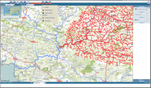
For the first one, the BD CARTHAGE, it is indeed possible to visualize data using traditional methods (WMS for instance). However, the user of this type of Data Base often has more elaborated problematics, for instance knowing what is located upstream from a specific spot on a river.
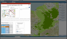
 For BDLISA, the case is somewhat different. This dataset provides the current knowledge regarding the aquifers that have been listed on the French territory and this information is nearly in 3D (the stacking-up order of entities is known, but not their depths). Even the visualization of this data is delicate and requires configured searches on the entities or the required levels of depth. Besides, the tool to generate a virtual log from a selected point is an essential functionality to fully make use of this knowledge.
The GeoProcesses were consequently implemented as supporting tools for these data. For each repository, they give an access point that is compliant with the OGC:WPS (Web Processing Service) allowing to handle the underlying data. Two demonstrators have been set up to show the possible integration of such services on a mapping client.
Dernière mise à jour le 18.05.2020


